Species Distribution Modelling

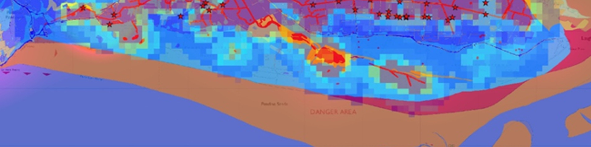
Local Records Centres rely on the efforts of recorders working in the field to send them biological records. However, records can only exist in areas recorders themselves have visited, regardless of the presence of species or not. This patchiness is a problem for LRCs…

Read more →

Mobile Recording

View the SeaTrust in the Field video produced by habitat INFO demonstrating SeaTrust’s use of mobile GIS solutions either below or by clicking here Mobile GIS allows companies to collect data rapidly, globally and accurately. It can lead to the development of large spatial databases…

Read more →

3D Analysis

habitat INFO’s 3D services include the analysis of terrain in order to identify areas which are visible from defined observation points. This is particularly useful during the planning of developments near to pre-existing developments. We are also able to provide 3D scenes, animations and…

Read more →

Cetacean recording

**NEW** View the SeaTrust in the Field video produced by habitat INFO demonstrating SeaTrust’s use of mobile GIS solutions. habitat INFO were approached by West Wales Biodiversity Information Centre (WWBIC) on behalf of SeaTrust, a registered charity recording Cetacean sightings between Pembrokeshire and Ireland….

Read more →

Dr Rob Davies, Director

Dr Rob Davies is a specialist in spatial data management with over 20 years of experience in applying GIS analysis to the fields of biodiversity conservation and sustainable development both in Africa and now Europe. He is currently UK-based and started his own GIS…

Read more →

Tim Wroblewski, GIS Analyst

Tim Wroblewski worked full-time with habitat INFO from February 2012 to February 2015 as a GIS Analyst and has since been working with us on an ad hoc basis. Initially he was involved in a project to map risk and vulnerability (R&V) to climate…

Read more →