 habitat INFO worked closely with the client, BirdLife International, to develop a bespoke web mapping tool. The project area covered the Red Sea and Rift Valley flyway; an important corridor through the Middle East and North-East Africa for migratory soaring birds on their journeys between their breeding grounds in Europe and Wintering grounds in Southern Africa. The goal was for a tool which enabled the end user to identify the overall sensitivity of migratory soaring birds within a given area to wind turbine development.
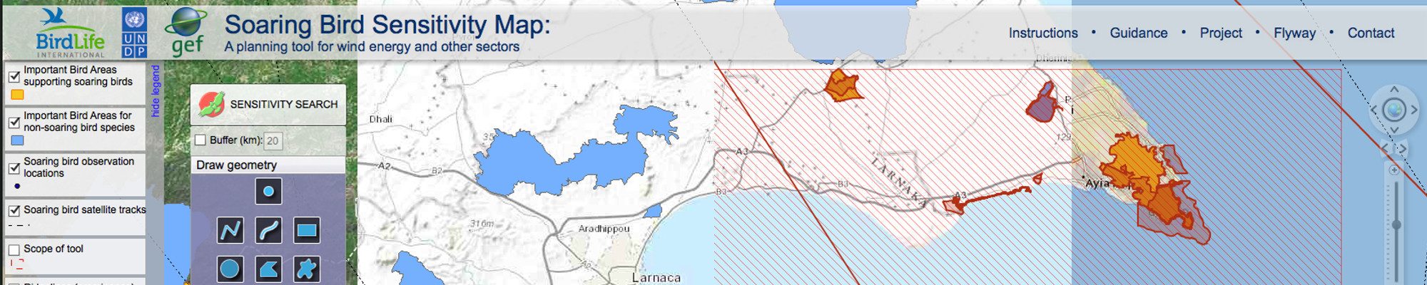
habitat INFO were involved throughout the process from helping to develop the algorithm defining the sensitivity of each species, through the organisation of the underlying database (Combining multiple data sources) to the serving of this data via an Adobe Flash based web tool. The tool leverages powerful capabilities giving the end user the ability to search a specific area (With different methods of defining this) and allowing them to produce well-presented and informative reports (In some cases ~600 pages in length).
The project followed a very tight timeframe but despite this habitat INFO delivered each milestone on time and delivered the finished product within the timeframe allowed. This was largely down to the excellent dialogue between ourselves and BirdLife International and the effective project management from both sides.
Example report…
