habitat INFO have a proven record when it comes to delivering Biodiversity layers having supplied them to Local Planning Authorities throughout Wales.
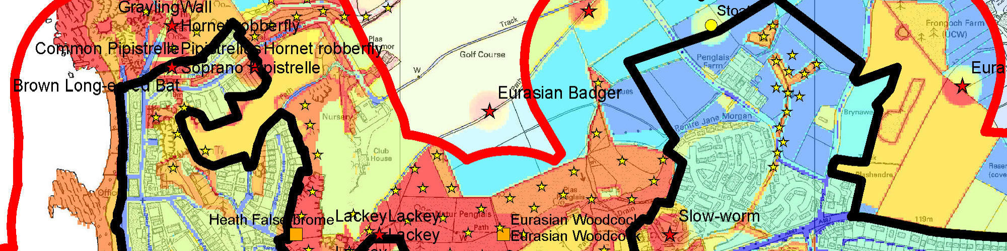
We supply a single GIS layer into which all known biodiversity layers (species, habitats, sites and connectivity) have been incorporated. Areas of high biodiversity value are coloured red, and areas where little is known about the biodiversity value are coloured blue. It means that members of the Forward Planning teams do not necessarily require knowledge of scientific names or area designations for interpretation.
The product has been well received because it provides an immediately accessible overview of our biodiversity knowledge and helps to find geographic reconciliation for the potentially conflicting demands of development and of conservation.
It is possible to automate the updating of this layer. Detailed GIS layers are supplied with the product for further information when required (e.g. species overlay shown here)
We work closely with the Local Records Centres relevant to the area in question in order to make sure the most up-to-data and accurate data is used in the process.
Clients to date include:
- Carmarthenshire County Council
- Pembrokeshire County Council
- Ceredigion County Council
- Gwynedd County Council